
Société informatique en région Pays-de-la-Loire
1 286 sociétés informatiques sont référencés sur la région Pays-de-la-Loire
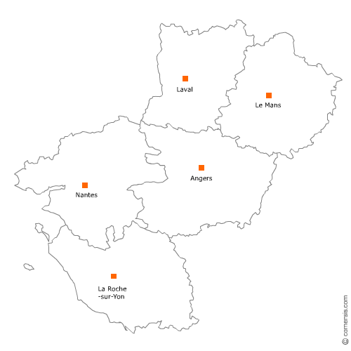
Vous recherchez une société informatique dans les Pays-de-la-Loire ?
La région Pays-de-la-Loire représente 3% des sociétés informatiques de France.
C'est le département de Loire-Atlantique qui compte le plus de sociétés informatiques dans les Pays-de-la-Loire.
C'est le département de Loire-Atlantique qui compte le plus de sociétés informatiques dans les Pays-de-la-Loire.
Société informatique dans le Maine-et-Loire (49)
Secteur d'Angers
Indice d'implantation
| Commune | Nb Pro | Habitants | Distance | |
|---|---|---|---|---|
| Angers - 49000 | 66 | 150125 | 0,0 | km |
Secteur de Loire-Authion
Indice d'implantation
| Commune | Nb Pro | Habitants | Distance | |
|---|---|---|---|---|
| Saint-Mathurin-sur-Loire - 49250 | 0 | 15471 | 0,0 | km |
| Trélazé - 49800 | 2 | 13125 | 11,9 | km |
| Saint-Barthélemy-d'Anjou - 49124 | 5 | 9077 | 14,7 | km |
| les Ponts-de-Cé - 49130 | 4 | 12112 | 15,4 | km |
| Soulaines-sur-Aubance - 49610 | 3 | 1232 | 16,1 | km |
| Saint-Sylvain-d'Anjou - 49480 | 1 | 6973 | 16,8 | km |
| Mûrs-Erigné - 49610 | 4 | 5368 | 17,7 | km |
| Sainte-Gemmes-sur-Loire - 49130 | 2 | 3521 | 18,1 | km |
| Avrillé - 49240 | 4 | 12972 | 22,9 | km |
| Beaucouzé - 49070 | 11 | 4935 | 24,7 | km |
| Montreuil-Juigné - 49460 | 1 | 7213 | 25,5 | km |
| Soulaire-et-Bourg - 49460 | 2 | 1461 | 25,7 | km |
| Saint-Lambert-la-Potherie - 49070 | 4 | 2513 | 28,2 | km |
| Saint-Clément-de-la-Place - 49370 | 1 | 2118 | 34,5 | km |
Secteur de Cholet
Indice d'implantation
| Commune | Nb Pro | Habitants | Distance | |
|---|---|---|---|---|
| Cholet - 49300 | 14 | 53890 | 0,0 | km |
| la Séguinière - 49280 | 4 | 3967 | 4,7 | km |
| la Tessoualle - 49280 | 1 | 3076 | 6,4 | km |
| Toutlemonde - 49360 | 1 | 1208 | 8,4 | km |
Secteur de Chalonnes-sur-Loire
Indice d'implantation
| Commune | Nb Pro | Habitants | Distance | |
|---|---|---|---|---|
| Chalonnes-sur-Loire - 49290 | 4 | 6528 | 0,0 | km |
| Saint-Georges-sur-Loire - 49170 | 2 | 3529 | 6,1 | km |
| la Possonnière - 49170 | 1 | 2416 | 6,5 | km |
| Champtocé-sur-Loire - 49123 | 1 | 1866 | 9,9 | km |
| Mozé-sur-Louet - 49610 | 1 | 2045 | 16,2 | km |
| Saint-Melaine-sur-Aubance - 49610 | 2 | 2044 | 20,4 | km |
| Juigné-sur-Loire - 49610 | 1 | 2621 | 22,4 | km |
| Brissac-Quincé - 49320 | 1 | 3059 | 24,2 | km |
Secteur de Saumur
Indice d'implantation
| Commune | Nb Pro | Habitants | Distance | |
|---|---|---|---|---|
| Saumur - 49400 | 4 | 27413 | 0,0 | km |
| Souzay-Champigny - 49400 | 1 | 797 | 5,9 | km |
| Doué-la-Fontaine - 49700 | 3 | 7584 | 16,2 | km |
Secteur de Segré-en-Anjou Bleu
Indice d'implantation
| Commune | Nb Pro | Habitants | Distance | |
|---|---|---|---|---|
| Segré - 49500 | 2 | 6925 | 0,0 | km |
| le Lion-d'Angers - 49220 | 1 | 4465 | 13,4 | km |
| Grez-Neuville - 49220 | 1 | 1464 | 17,0 | km |
| le Louroux-Béconnais - 49370 | 1 | 3016 | 18,7 | km |
| Candé - 49440 | 1 | 2916 | 19,1 | km |
| Sceaux-d'Anjou - 49330 | 1 | 1132 | 21,0 | km |
Secteur de Baugé-en-Anjou
Indice d'implantation
| Commune | Nb Pro | Habitants | Distance | |
|---|---|---|---|---|
| Baugé - 49150 | 1 | 11873 | 0,0 | km |
| Beaufort-en-Vallée - 49250 | 1 | 7009 | 14,2 | km |
| Mazé - 49630 | 2 | 5578 | 15,7 | km |
| Tiercé - 49125 | 2 | 4287 | 28,3 | km |
Secteur de Sèvremoine
Indice d'implantation
| Commune | Nb Pro | Habitants | Distance | |
|---|---|---|---|---|
| Saint-Macaire-en-Mauges - 49450 | 2 | 24970 | 0,0 | km |
| Chemillé - 49120 | 2 | 21304 | 22,1 | km |
Société informatique dans la Mayenne (53)
Secteur de Laval
Indice d'implantation
| Commune | Nb Pro | Habitants | Distance | |
|---|---|---|---|---|
| Laval - 53000 | 25 | 50479 | 0,0 | km |
| Saint-Berthevin - 53940 | 1 | 7331 | 4,3 | km |
| l'Huisserie - 53970 | 1 | 4197 | 5,5 | km |
| Bonchamp-lès-Laval - 53960 | 1 | 5829 | 5,6 | km |
| Ahuillé - 53940 | 2 | 1848 | 9,3 | km |
| Argentré - 53210 | 1 | 2717 | 9,9 | km |
| Courbeveille - 53230 | 1 | 653 | 12,1 | km |
| Loiron - 53320 | 1 | 2461 | 12,1 | km |
| Saint-Ouën-des-Toits - 53410 | 1 | 1673 | 12,3 | km |
| Saint-Hilaire-du-Maine - 53380 | 1 | 837 | 20,7 | km |
| Meslay-du-Maine - 53170 | 1 | 2797 | 21,2 | km |
| Fromentières - 53200 | 1 | 830 | 24,4 | km |
| Juvigné - 53380 | 1 | 1486 | 26,2 | km |
| Château-Gontier - 53200 | 1 | 16 | 27,4 | km |
| Craon - 53400 | 1 | 4481 | 28,1 | km |
| Saint-Jean-sur-Erve - 53270 | 1 | 452 | 28,7 | km |
| Daon - 53200 | 1 | 471 | 37,1 | km |
| Renazé - 53800 | 1 | 2626 | 37,2 | km |
| Saint-Denis-d'Anjou - 53290 | 1 | 1549 | 39,8 | km |
Secteur de Mayenne
Indice d'implantation
| Commune | Nb Pro | Habitants | Distance | |
|---|---|---|---|---|
| Mayenne - 53100 | 0 | 13376 | 0,0 | km |
| Lassay-les-Châteaux - 53110 | 1 | 2393 | 17,6 | km |
| Saint-Denis-de-Gastines - 53500 | 1 | 1607 | 18,5 | km |
| Montenay - 53500 | 1 | 1361 | 20,8 | km |
| Chevaigné-du-Maine - 53250 | 1 | 186 | 22,7 | km |
| Évron - 53600 | 1 | 8 | 22,7 | km |
| Saint-Pierre-des-Nids - 53370 | 1 | 1946 | 39,6 | km |
Société informatique en Vendée (85)
Secteur de Roche-sur-Yon
Indice d'implantation
| Commune | Nb Pro | Habitants | Distance | |
|---|---|---|---|---|
| la Roche-sur-Yon - 85000 | 19 | 52732 | 0,0 | km |
| Mouilleron-le-Captif - 85000 | 1 | 4829 | 5,8 | km |
| Venansault - 85190 | 1 | 4595 | 6,5 | km |
| Dompierre-sur-Yon - 85170 | 2 | 4144 | 7,9 | km |
| Aubigny - 85430 | 1 | 6074 | 8,6 | km |
| la Chaize-le-Vicomte - 85310 | 3 | 3578 | 10,4 | km |
| Saint-Florent-des-Bois - 85310 | 2 | 4030 | 12,4 | km |
Secteur de Herbiers
Indice d'implantation
| Commune | Nb Pro | Habitants | Distance | |
|---|---|---|---|---|
| les Herbiers - 85500 | 7 | 15933 | 0,0 | km |
| Saint-Paul-en-Pareds - 85500 | 2 | 1253 | 5,8 | km |
| Mouchamps - 85640 | 1 | 2821 | 10,9 | km |
| Mortagne-sur-Sèvre - 85290 | 1 | 5958 | 13,0 | km |
| Saint-Aubin-des-Ormeaux - 85130 | 1 | 1314 | 13,4 | km |
| la Boissière-de-Montaigu - 85600 | 1 | 2259 | 15,8 | km |
| Treize-Septiers - 85600 | 1 | 3053 | 20,6 | km |
| Cugand - 85610 | 1 | 3366 | 27,9 | km |
Secteur de Fontenay-le-Comte
Indice d'implantation
| Commune | Nb Pro | Habitants | Distance | |
|---|---|---|---|---|
| Fontenay-le-Comte - 85200 | 9 | 13647 | 0,0 | km |
| Maillezais - 85420 | 1 | 986 | 11,8 | km |
| Mouzeuil-Saint-Martin - 85370 | 1 | 1232 | 13,8 | km |
| Faymoreau - 85240 | 1 | 216 | 15,5 | km |
| Antigny - 85120 | 2 | 1051 | 17,3 | km |
| Benet - 85490 | 1 | 3930 | 19,5 | km |
Secteur de Challans
Indice d'implantation
| Commune | Nb Pro | Habitants | Distance | |
|---|---|---|---|---|
| Challans - 85300 | 7 | 19501 | 0,0 | km |
| Sallertaine - 85300 | 1 | 2864 | 6,0 | km |
| la Garnache - 85710 | 2 | 4663 | 6,2 | km |
| Châteauneuf - 85710 | 1 | 968 | 8,1 | km |
| Bois-de-Céné - 85710 | 1 | 1903 | 10,1 | km |
| Beauvoir-sur-Mer - 85230 | 2 | 3942 | 14,6 | km |
Secteur de Talmont-Saint-Hilaire
Indice d'implantation
| Commune | Nb Pro | Habitants | Distance | |
|---|---|---|---|---|
| Talmont-Saint-Hilaire - 85440 | 2 | 7263 | 0,0 | km |
| Jard-sur-Mer - 85520 | 1 | 2644 | 6,4 | km |
| Grosbreuil - 85440 | 1 | 2145 | 8,0 | km |
| Saint-Mathurin - 85150 | 4 | 2150 | 13,2 | km |
| les Sables-d'Olonne - 85100 | 2 | 42 | 13,3 | km |
| la Boissière-des-Landes - 85430 | 1 | 1326 | 16,2 | km |
Secteur d'Aizenay
Indice d'implantation
| Commune | Nb Pro | Habitants | Distance | |
|---|---|---|---|---|
| Aizenay - 85190 | 1 | 8741 | 0,0 | km |
| le Poiré-sur-Vie - 85170 | 2 | 8298 | 8,2 | km |
| Belleville-sur-Vie - 85170 | 1 | 5795 | 14,3 | km |
| les Lucs-sur-Boulogne - 85170 | 2 | 3340 | 14,3 | km |
| Falleron - 85670 | 1 | 1532 | 17,3 | km |
| Saint-Denis-la-Chevasse - 85170 | 1 | 2235 | 21,1 | km |
| Rocheservière - 85620 | 2 | 3065 | 23,1 | km |
Secteur d'Essarts-en-Bocage
Indice d'implantation
| Commune | Nb Pro | Habitants | Distance | |
|---|---|---|---|---|
| les Essarts - 85140 | 2 | 8460 | 0,0 | km |
| Saint-André-Goule-d'Oie - 85250 | 1 | 1764 | 7,3 | km |
| Chavagnes-en-Paillers - 85250 | 1 | 3490 | 13,2 | km |
| les Brouzils - 85260 | 1 | 2702 | 14,3 | km |
| Montaigu - 85600 | 2 | 19 | 23,4 | km |
Secteur de Saint-Hilaire-de-Riez
Indice d'implantation
| Commune | Nb Pro | Habitants | Distance | |
|---|---|---|---|---|
| Saint-Hilaire-de-Riez - 85270 | 2 | 11169 | 0,0 | km |
| Saint-Gilles-Croix-de-Vie - 85800 | 1 | 7469 | 3,2 | km |
| Notre-Dame-de-Riez - 85270 | 1 | 1984 | 3,9 | km |
| Givrand - 85800 | 1 | 2032 | 7,1 | km |
| Bretignolles-sur-Mer - 85470 | 1 | 4337 | 12,5 | km |
Secteur de Sèvremont
Indice d'implantation
| Commune | Nb Pro | Habitants | Distance | |
|---|---|---|---|---|
| la Flocellière - 85700 | 0 | 6416 | 0,0 | km |
| Pouzauges - 85700 | 2 | 5536 | 5,9 | km |
| la Meilleraie-Tillay - 85700 | 1 | 1590 | 10,3 | km |
| Monsireigne - 85110 | 2 | 957 | 11,9 | km |
Secteur de Luçon
Indice d'implantation
| Commune | Nb Pro | Habitants | Distance | |
|---|---|---|---|---|
| Luçon - 85400 | 0 | 9361 | 0,0 | km |
| Chaillé-les-Marais - 85450 | 1 | 1921 | 13,0 | km |
| Saint-Étienne-de-Brillouet - 85210 | 1 | 558 | 15,1 | km |
| Thiré - 85210 | 1 | 573 | 16,1 | km |
| la Tranche-sur-Mer - 85360 | 1 | 2774 | 24,3 | km |
| la Caillère-Saint-Hilaire - 85410 | 1 | 1100 | 26,7 | km |
Secteur de Chantonnay
Indice d'implantation
| Commune | Nb Pro | Habitants | Distance | |
|---|---|---|---|---|
| Chantonnay - 85110 | 1 | 8271 | 0,0 | km |
| Saint-Martin-des-Noyers - 85140 | 1 | 2271 | 10,1 | km |
| Bournezeau - 85480 | 1 | 3265 | 10,5 | km |
| Saint-Prouant - 85110 | 2 | 1504 | 10,7 | km |
Secteur de Saint-Jean-de-Monts
Indice d'implantation
| Commune | Nb Pro | Habitants | Distance | |
|---|---|---|---|---|
| Saint-Jean-de-Monts - 85160 | 1 | 8349 | 0,0 | km |
| le Perrier - 85300 | 1 | 1897 | 5,9 | km |
| Soullans - 85300 | 1 | 4202 | 12,1 | km |
| Noirmoutier-en-l'Île - 85330 | 1 | 4587 | 27,8 | km |
Société informatique dans la Sarthe (72)
Secteur de Mans
Indice d'implantation
| Commune | Nb Pro | Habitants | Distance | |
|---|---|---|---|---|
| le Mans - 72000 | 61 | 144244 | 0,0 | km |
Secteur de Changé
Indice d'implantation
| Commune | Nb Pro | Habitants | Distance | |
|---|---|---|---|---|
| Changé - 72560 | 0 | 6407 | 0,0 | km |
| Parigné-l'Évêque - 72250 | 2 | 4842 | 8,5 | km |
| Brette-les-Pins - 72250 | 1 | 2137 | 9,3 | km |
| Saint-Corneille - 72460 | 1 | 1324 | 9,8 | km |
| Montfort-le-Gesnois - 72450 | 1 | 3038 | 11,8 | km |
| Neuville-sur-Sarthe - 72190 | 1 | 2362 | 11,9 | km |
| Spay - 72700 | 1 | 2899 | 12,1 | km |
| Étival-lès-le-Mans - 72700 | 5 | 1962 | 15,1 | km |
| la Bazoge - 72650 | 1 | 3661 | 15,5 | km |
| Guécélard - 72230 | 1 | 2895 | 17,2 | km |
| Degré - 72550 | 1 | 787 | 17,3 | km |
| Écommoy - 72220 | 2 | 4658 | 17,9 | km |
| Beaufay - 72110 | 1 | 1429 | 18,7 | km |
| Coulans-sur-Gée - 72550 | 1 | 1689 | 20,7 | km |
| Ballon - 72290 | 1 | 2174 | 21,1 | km |
| Yvré-le-Pôlin - 72330 | 2 | 1793 | 21,3 | km |
| Saint-Vincent-du-Lorouër - 72150 | 1 | 902 | 23,8 | km |
| Amné - 72540 | 1 | 530 | 26,0 | km |
| Maresché - 72170 | 1 | 905 | 26,6 | km |
| Conlie - 72240 | 1 | 1865 | 27,0 | km |
| Chahaignes - 72340 | 1 | 740 | 32,4 | km |
| Château-du-Loir - 72500 | 1 | 4750 | 34,1 | km |
| Marçon - 72340 | 1 | 1027 | 35,4 | km |
| la Chartre-sur-le-Loir - 72340 | 1 | 1460 | 36,1 | km |
| Sillé-le-Guillaume - 72140 | 1 | 2357 | 37,6 | km |
| Dissay-sous-Courcillon - 72500 | 1 | 960 | 38,6 | km |
Secteur d'Allonnes
Indice d'implantation
| Commune | Nb Pro | Habitants | Distance | |
|---|---|---|---|---|
| Allonnes - 72700 | 1 | 11047 | 0,0 | km |
| Rouillon - 72700 | 1 | 2295 | 4,1 | km |
| Pruillé-le-Chétif - 72700 | 1 | 1278 | 4,4 | km |
| la Chapelle-Saint-Aubin - 72650 | 1 | 2286 | 7,0 | km |
| Ruaudin - 72230 | 4 | 3412 | 8,6 | km |
| Sargé-lès-le-Mans - 72190 | 1 | 3658 | 9,4 | km |
| Saint-Saturnin - 72650 | 1 | 2484 | 9,7 | km |
| Mulsanne - 72230 | 1 | 4772 | 9,8 | km |
| Yvré-l'Évêque - 72530 | 2 | 4286 | 10,0 | km |
Secteur de Sablé-sur-Sarthe
Indice d'implantation
| Commune | Nb Pro | Habitants | Distance | |
|---|---|---|---|---|
| Sablé-sur-Sarthe - 72300 | 5 | 12575 | 0,0 | km |
| Asnières-sur-Vègre - 72430 | 1 | 391 | 8,9 | km |
| Parcé-sur-Sarthe - 72300 | 2 | 2151 | 9,8 | km |
| Chevillé - 72350 | 1 | 408 | 14,4 | km |
Secteur de Flèche
Indice d'implantation
| Commune | Nb Pro | Habitants | Distance | |
|---|---|---|---|---|
| la Flèche - 72200 | 2 | 14992 | 0,0 | km |
| la Chapelle-d'Aligné - 72300 | 1 | 1613 | 12,7 | km |
| Malicorne-sur-Sarthe - 72270 | 1 | 1934 | 13,0 | km |
| le Lude - 72800 | 2 | 3899 | 17,8 | km |
Secteur de Ferté-Bernard
Indice d'implantation
| Commune | Nb Pro | Habitants | Distance | |
|---|---|---|---|---|
| la Ferté-Bernard - 72400 | 0 | 9116 | 0,0 | km |
| Bouër - 72390 | 1 | 330 | 11,9 | km |
| Bonnétable - 72110 | 1 | 3915 | 16,5 | km |
| la Chapelle-Saint-Rémy - 72160 | 1 | 931 | 16,6 | km |
| Dollon - 72390 | 1 | 1501 | 17,3 | km |
Société informatique en Loire-Atlantique (44)
Secteur de Nantes
Indice d'implantation
| Commune | Nb Pro | Habitants | Distance | |
|---|---|---|---|---|
| Nantes - 44000 | 305 | 292718 | 0,0 | km |
Secteur de Saint-Herblain
Indice d'implantation
| Commune | Nb Pro | Habitants | Distance | |
|---|---|---|---|---|
| Saint-Herblain - 44800 | 67 | 43784 | 0,0 | km |
Secteur d'Orvault
Indice d'implantation
| Commune | Nb Pro | Habitants | Distance | |
|---|---|---|---|---|
| Orvault - 44700 | 20 | 24922 | 0,0 | km |
| Carquefou - 44470 | 42 | 18646 | 10,1 | km |
Secteur de Saint-Sébastien-sur-Loire
Indice d'implantation
| Commune | Nb Pro | Habitants | Distance | |
|---|---|---|---|---|
| Saint-Sébastien-sur-Loire - 44230 | 15 | 25610 | 0,0 | km |
| Basse-Goulaine - 44115 | 7 | 8361 | 3,4 | km |
| la Chapelle-sur-Erdre - 44240 | 33 | 18412 | 10,9 | km |
Secteur de Rezé
Indice d'implantation
| Commune | Nb Pro | Habitants | Distance | |
|---|---|---|---|---|
| Rezé - 44400 | 33 | 39568 | 0,0 | km |
| Bouguenais - 44340 | 12 | 18662 | 5,7 | km |
| Saint-Aignan-Grandlieu - 44860 | 9 | 3779 | 9,6 | km |
Secteur de Vertou
Indice d'implantation
| Commune | Nb Pro | Habitants | Distance | |
|---|---|---|---|---|
| Vertou - 44120 | 18 | 22820 | 0,0 | km |
| les Sorinières - 44840 | 2 | 7754 | 4,9 | km |
| Sainte-Luce-sur-Loire - 44980 | 12 | 14170 | 9,1 | km |
| Thouaré-sur-Loire - 44470 | 4 | 8750 | 11,0 | km |
Secteur de Nort-sur-Erdre
Indice d'implantation
| Commune | Nb Pro | Habitants | Distance | |
|---|---|---|---|---|
| Nort-sur-Erdre - 44390 | 6 | 8272 | 0,0 | km |
| Saffré - 44390 | 1 | 3746 | 8,9 | km |
| Saint-Mars-du-Désert - 44850 | 4 | 4396 | 11,0 | km |
| Sucé-sur-Erdre - 44240 | 6 | 6590 | 11,2 | km |
| Grandchamps-des-Fontaines - 44119 | 2 | 5435 | 11,4 | km |
| Héric - 44810 | 4 | 5661 | 11,6 | km |
| Treillières - 44119 | 2 | 8226 | 15,4 | km |
| Vigneux-de-Bretagne - 44360 | 7 | 5628 | 21,7 | km |
| Fay-de-Bretagne - 44130 | 1 | 3445 | 21,9 | km |
Secteur de Saint-Nazaire
Indice d'implantation
| Commune | Nb Pro | Habitants | Distance | |
|---|---|---|---|---|
| Saint-Nazaire - 44600 | 18 | 68513 | 0,0 | km |
| Montoir-de-Bretagne - 44550 | 3 | 7051 | 7,4 | km |
| Saint-André-des-Eaux - 44117 | 2 | 5883 | 7,8 | km |
| Pornichet - 44380 | 7 | 10531 | 9,0 | km |
Secteur de Couëron
Indice d'implantation
| Commune | Nb Pro | Habitants | Distance | |
|---|---|---|---|---|
| Couëron - 44220 | 12 | 20084 | 0,0 | km |
| Saint-Jean-de-Boiseau - 44640 | 1 | 5449 | 2,0 | km |
| la Montagne - 44620 | 5 | 5988 | 4,2 | km |
| Indre - 44610 | 1 | 4104 | 4,5 | km |
| Brains - 44830 | 1 | 2640 | 4,8 | km |
| Sautron - 44880 | 5 | 6968 | 7,0 | km |
| Bouaye - 44830 | 2 | 6555 | 8,1 | km |
Secteur de Clisson
Indice d'implantation
| Commune | Nb Pro | Habitants | Distance | |
|---|---|---|---|---|
| Clisson - 44190 | 6 | 6662 | 0,0 | km |
| Gétigné - 44190 | 1 | 3532 | 2,8 | km |
| Saint-Lumine-de-Clisson - 44190 | 1 | 2067 | 4,3 | km |
| Monnières - 44690 | 1 | 1998 | 7,5 | km |
| Remouillé - 44140 | 1 | 1787 | 8,1 | km |
| Boussay - 44190 | 1 | 2677 | 8,6 | km |
| Aigrefeuille-sur-Maine - 44140 | 2 | 3516 | 9,0 | km |
| Château-Thébaud - 44690 | 2 | 2934 | 11,4 | km |
| la Haie-Fouassière - 44690 | 3 | 4455 | 11,7 | km |
| Saint-Fiacre-sur-Maine - 44690 | 1 | 1147 | 12,0 | km |
| Haute-Goulaine - 44115 | 2 | 5572 | 16,7 | km |
| Vieillevigne - 44116 | 2 | 3941 | 17,3 | km |
Secteur de Guérande
Indice d'implantation
| Commune | Nb Pro | Habitants | Distance | |
|---|---|---|---|---|
| Guérande - 44350 | 3 | 15858 | 0,0 | km |
| le Pouliguen - 44510 | 1 | 4647 | 6,3 | km |
| la Baule-Escoublac - 44500 | 8 | 15456 | 6,3 | km |
| la Turballe - 44420 | 3 | 4521 | 6,6 | km |
| Batz-sur-Mer - 44740 | 1 | 3008 | 7,0 | km |
| Piriac-sur-Mer - 44420 | 1 | 2178 | 7,9 | km |
| Saint-Lyphard - 44410 | 2 | 4482 | 12,0 | km |
| Herbignac - 44410 | 1 | 6307 | 15,9 | km |
| Pénestin - 56760 | 1 | 1790 | 17,6 | km |
Secteur de Saint-Philbert-de-Grand-Lieu
Indice d'implantation
| Commune | Nb Pro | Habitants | Distance | |
|---|---|---|---|---|
| Saint-Philbert-de-Grand-Lieu - 44310 | 6 | 8619 | 0,0 | km |
| Saint-Colomban - 44310 | 1 | 3229 | 5,3 | km |
| la Chevrolière - 44118 | 8 | 5241 | 6,8 | km |
| Pont-Saint-Martin - 44860 | 1 | 5640 | 10,7 | km |
| Montbert - 44140 | 2 | 2987 | 11,8 | km |
| le Bignon - 44140 | 3 | 3554 | 13,3 | km |
Secteur de Vallet
Indice d'implantation
| Commune | Nb Pro | Habitants | Distance | |
|---|---|---|---|---|
| Vallet - 44330 | 3 | 8625 | 0,0 | km |
| le Landreau - 44430 | 2 | 2932 | 5,5 | km |
| la Regrippière - 44330 | 1 | 1525 | 7,1 | km |
| la Boissière-du-Doré - 44430 | 1 | 999 | 8,5 | km |
| le Loroux-Bottereau - 44430 | 5 | 7879 | 10,3 | km |
| la Chapelle-Basse-Mer - 44450 | 2 | 6595 | 13,3 | km |
| Saint-Julien-de-Concelles - 44450 | 3 | 6813 | 13,7 | km |
Secteur de Pornic
Indice d'implantation
| Commune | Nb Pro | Habitants | Distance | |
|---|---|---|---|---|
| Pornic - 44210 | 9 | 14288 | 0,0 | km |
| la Plaine-sur-Mer - 44770 | 1 | 3977 | 6,9 | km |
| Saint-Michel-Chef-Chef - 44730 | 1 | 4535 | 7,8 | km |
| Préfailles - 44770 | 1 | 1224 | 8,8 | km |
| Bourgneuf-en-Retz - 44580 | 1 | 4851 | 14,3 | km |
| Saint-Hilaire-de-Chaléons - 44680 | 1 | 2136 | 18,3 | km |
| Sainte-Pazanne - 44680 | 2 | 6074 | 22,4 | km |
| Port-Saint-Père - 44710 | 1 | 2864 | 27,1 | km |
Secteur de Savenay
Indice d'implantation
| Commune | Nb Pro | Habitants | Distance | |
|---|---|---|---|---|
| Savenay - 44260 | 2 | 8100 | 0,0 | km |
| la Chapelle-Launay - 44260 | 1 | 2810 | 2,6 | km |
| Prinquiau - 44260 | 1 | 3382 | 5,3 | km |
| Campbon - 44750 | 2 | 3904 | 6,0 | km |
| Malville - 44260 | 3 | 3343 | 6,0 | km |
| Cordemais - 44360 | 1 | 3431 | 9,3 | km |
| le Temple-de-Bretagne - 44360 | 1 | 1873 | 11,9 | km |
| Saint-Étienne-de-Montluc - 44360 | 4 | 6627 | 15,4 | km |
Secteur de Loireauxence
Indice d'implantation
| Commune | Nb Pro | Habitants | Distance | |
|---|---|---|---|---|
| Varades - 44370 | 2 | 7310 | 0,0 | km |
| Ancenis - 44150 | 8 | 10 | 11,4 | km |
| Oudon - 44521 | 1 | 3614 | 19,8 | km |
| le Cellier - 44850 | 1 | 3705 | 24,9 | km |
| Trans-sur-Erdre - 44440 | 1 | 1016 | 27,9 | km |
| Joué-sur-Erdre - 44440 | 1 | 2326 | 31,9 | km |
Secteur de Pontchâteau
Indice d'implantation
| Commune | Nb Pro | Habitants | Distance | |
|---|---|---|---|---|
| Pontchâteau - 44160 | 5 | 10191 | 0,0 | km |
| Saint-Gildas-des-Bois - 44530 | 1 | 3617 | 9,9 | km |
| Guenrouet - 44530 | 1 | 3254 | 14,0 | km |
Secteur de Machecoul-Saint-Même
Indice d'implantation
| Commune | Nb Pro | Habitants | Distance | |
|---|---|---|---|---|
| Machecoul - 44270 | 2 | 7267 | 0,0 | km |
| la Marne - 44270 | 1 | 1371 | 6,3 | km |
| Legé - 44650 | 1 | 4498 | 20,8 | km |
Secteur de Châteaubriant
Indice d'implantation
| Commune | Nb Pro | Habitants | Distance | |
|---|---|---|---|---|
| Châteaubriant - 44110 | 1 | 11866 | 0,0 | km |
| Erbray - 44110 | 1 | 2948 | 8,3 | km |
| Rougé - 44660 | 1 | 2240 | 9,0 | km |
| Grand-Auverné - 44520 | 1 | 807 | 14,7 | km |
Secteur de Blain
Indice d'implantation
| Commune | Nb Pro | Habitants | Distance | |
|---|---|---|---|---|
| Blain - 44130 | 0 | 9543 | 0,0 | km |
| le Gâvre - 44130 | 1 | 1718 | 5,1 | km |
| Vay - 44170 | 2 | 2047 | 9,9 | km |
| Puceul - 44390 | 1 | 1055 | 12,2 | km |
Secteur de Saint-Brevin-les-Pins
Indice d'implantation
| Commune | Nb Pro | Habitants | Distance | |
|---|---|---|---|---|
| Saint-Brevin-les-Pins - 44250 | 0 | 13134 | 0,0 | km |
| Corsept - 44560 | 1 | 2710 | 8,4 | km |